Integrated Land Use Plans
One of the recommendations presented in the Eastern Corridor Major Investment Study (MIS) completed in 2000, was to better understand the complex land use issues of the Eastern Corridor before specific transportation solutions were developed.
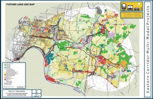
Eastern Corridor Land Use Vision Plan, completed in 2002, identified a future land use scenario that balanced economic and community development issues with natural resource preservation and enhancement needs. This study was led by the Hamilton County Regional Planning Commission and included participation by political jurisdictions, environmental groups, business leaders, public agencies and citizen planners.
The Eastern Corridor LUVP was incorporated into land use, zoning and development decisions by local jurisdictions. The LUVP was updated in 2009. Today, the information from these documents continues to be referenced as transportation improvements for the Eastern Corridor are developed.
Click here to view a larger image of the Future Land Use Vision Plan map.

