Overview
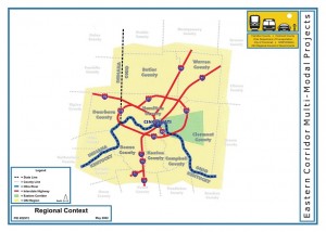
The Eastern Corridor is a program of multi-modal transportation investments designed to better connect central Cincinnati and the communities extending eastward through Hamilton County and into western Clermont County.
The Program incorporates multiple transportation options (including new and expanded roadways, new rail transit, expanded bus routes, and improvements for bicyclists and pedestrians) to address current and future need. The Program has been developed through a comprehensive project development process, which has included extensive economic development, land use visioning and environmental impact studies conducted, all of which have been conducted in close collaboration with the Eastern Corridor communities.
The 165 square-mile Eastern Corridor study area includes multiple political jurisdictions and communities, economic and employment centers, existing and future development zones, as well as sensitive environmental resources that are all being jointly considered in the development a long-term transportation solution for the area.

